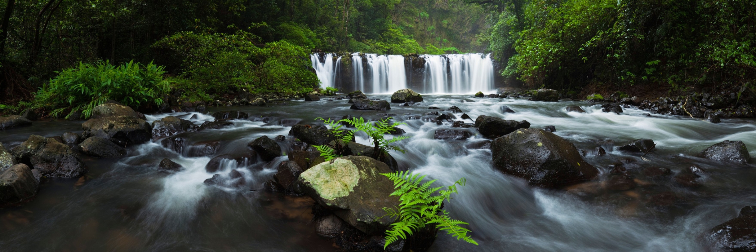
Rainforest and Waterfalls at a Glance
The Wet Tropics rainforest around Cairns is the oldest continuously surviving tropical rainforest on Earth. The Atherton Tablelands waterfall circuit is the easiest way to see several falls in one day. This guide covers the best rainforest walks and waterfalls.
“In the world’s oldest tropical rainforest, every waterfall is a gift — cool water and green light and the sound of life in full chorus.”
Rainforest and Waterfalls: What Makes the Wet Tropics Different
In short: The Wet Tropics rainforest around Cairns is the oldest continuously surviving tropical rainforest on Earth, and the Atherton Tablelands waterfall circuit is the easiest way to see several of its best waterfalls in a day. Check Queensland Parks alerts before you drive out, because tracks and swimming holes close regularly after rain.
This page answers: where the best rainforest and waterfall areas are, which waterfalls you can swim in and how to judge one safely, whether you need a guided tour, how to check whether a walking track is open before you drive out, what wildlife you might see, and when to go.
Tropical North Queensland is home to one of the most extraordinary waterfall landscapes on the planet. The Wet Tropics World Heritage Area — which stretches along the coast and hinterland from Townsville to Cooktown — receives some of the highest rainfall in Australia during the Wet Season, and the result is a cascade of waterfalls, swimming holes, and rushing creeks that bring the rainforest to life in ways that leave visitors genuinely speechless.
The Atherton Tablelands is the heart of the waterfall experience. Millaa Millaa Falls, Zillie Falls, Ellinjaa Falls, Nandroya Falls, Josephine Falls, Malanda Falls, and dozens more are scattered across the plateau and its escarpments, each with its own character and its own perfect swimming hole. The Millaa Millaa Waterfall Circuit is the most accessible introduction — three falls in a single afternoon drive — but those with more time to explore will find that the deeper into the Tablelands they venture, the more magnificent the rewards become.
The Daintree and Cape Tribulation region adds its own dimension to the rainforest experience. Here, the oldest tropical rainforest on Earth (estimated at over 100 million years old) presses down to the beach in a landscape found nowhere else. Swimming in forest streams fed by waterfalls on the Bloomfield Track or the Alexandra Range delivers an experience that is simultaneously ancient and deeply alive.
For visitors to Cairns, a dedicated rainforest and waterfall day — or ideally two or three days — on the Tablelands is one of the most rewarding things it is possible to do in Australia. The same Wet Tropics World Heritage rainforest continues well south of Cairns, too. At Mission Beach, it takes a quieter, less-visited form — forest walks rather than a Skyrail or a river cruise, and a resident cassowary population rather than a chance sighting.
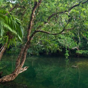
Before You Drive Out: Check the Track Is Open
This is the most avoidable wasted day in Tropical North Queensland. Walking tracks, lookouts, swimming holes and whole sections of national park close regularly — after heavy rain, for track repairs, during cyclone recovery, and for fire management. Closures are often decided the same morning, and a track that was open when a guidebook was written may have been closed for two years.
Queensland Parks and Wildlife Service publishes park alerts for every Queensland national park, and it is the only source that is current. Check the alert for the specific park the day before you go and again on the morning, particularly in the wet season. We deliberately do not publish a list of closures here, because a list like that is wrong within days and a wrong list is worse than no list.
Swimming Holes: How to Judge One Safely
The Tablelands swimming holes and crater lakes are freshwater, well inland, and among the great pleasures of this region. They are also natural water, and the rules are different from a pool.
Swim only where signage permits it. Never enter the water immediately after heavy rain, when currents in creek systems change fast and debris moves downstream. Never jump or dive into water whose depth you have not checked on the day, because submerged logs shift with every wet season. Keep away from the base of a waterfall in flow, where recirculating currents can hold a swimmer under. And remember that estuarine crocodiles range much further upstream than most visitors assume; the Be Crocwise guidance explains where that habitat actually begins.
More Questions About Rainforest and Waterfalls
How do you know if a walking track or waterfall is open?
Check the park alerts published by Queensland Parks and Wildlife Service for the specific national park, the day before you travel and again that morning. Closures follow heavy rain, track repairs, cyclone damage and fire management, and they are often decided the same day. We do not publish closure lists here because they go out of date within days.
Which waterfalls near Cairns can you swim in?
Several on the Atherton Tablelands waterfall circuit have designated swimming areas, along with the crater lakes. Swim only where signage permits, and treat every natural waterhole as a place whose depth and currents changed in the last wet season. Do not swim immediately after heavy rain, and keep clear of the base of a waterfall in flow.
Are there crocodiles in the rainforest swimming holes?
The Tablelands crater lakes and the well-known waterfall swimming areas are freshwater, elevated and inland, and are not considered crocodile habitat. Lowland creeks, rivers and anything tidal are a completely different matter, and estuarine crocodiles range much further upstream than most visitors expect. Read the signage, and read the Queensland Government Be Crocwise guidance before you go anywhere unsigned.
Do you need a guided tour to see the rainforest and waterfalls?
No, but it depends on the day you want. The Tablelands waterfall circuit is a straightforward self-drive and gives you time at each stop. A guided tour is better value if you want wildlife spotting, Indigenous interpretation or the Daintree, and it removes the driving on winding roads in tropical rain.
When is the best time to see the waterfalls?
The waterfalls are at their most powerful in and just after the wet season, roughly January to April, when the rainforest is at its greenest. The dry season, May to October, gives easier driving, better walking conditions and clearer swimming, with gentler flows. Both are worth doing; they are simply different experiences.
What should you wear and bring?
Closed shoes with grip, because boardwalks and rock are slippery year-round. Insect repellent, drinking water, a rain jacket in any season, and a swimsuit if you plan to use a designated swimming area. Mobile coverage is patchy on the Tablelands, so download maps before you leave Cairns.
Is the rainforest accessible for wheelchair users?
In places, yes, and Queensland Parks and Wildlife Service is specific about which places. QPWS describes the Baral Marrjanga track at Mossman Gorge as suitable for wheelchairs, strollers and the vision-impaired; the Dubuji, Kulki and Madja boardwalks near Cape Tribulation, the Jindalba boardwalk at Cow Bay and the Din Din Barron Falls boardwalk and lookouts as wheelchair accessible, may require assistance; and the twin kauris walk at Lake Barrine as a sealed bitumen track accessible with assistance. QPWS states plainly that there are no wheelchair-accessible facilities at Mount Hypipamee, Malanda Falls, Danbulla or Kuranda National Park. Surfaces and gradients vary a great deal between sites, the council-managed Tablelands waterfalls are unverified, and we do not estimate any of it. The full site-by-site table is further down this page. See also our accessible Cairns guide.
Accessibility: What the Land Managers Actually Publish
Accessibility is one of the few things we will never estimate. We do not read it off a photograph, a car park, a track grade or the absence of a warning sign. Everything in the table below is what the responsible land manager states, checked at the source on 3 August 2026. Where a site is blank, it is genuinely blank: nobody has published it, and we would rather tell you that than guess.
Queensland Parks and Wildlife Service makes an honest general point that is worth carrying with you: not all park facilities meet Australian standards, but many are suitable for visitors using a wheelchair who have someone to assist them, and some tracks have tactile indicators for visitors with a vision impairment. Certified guide, hearing and assistance dogs are welcome in all public areas of Queensland’s parks and forests. You can read the full guidance on QPWS park accessibility.
| Site | What the land manager states | Authority |
|---|---|---|
| Mossman Gorge — Baral Marrjanga track, Daintree National Park (CYPAL) | QPWS: Grade 1 track, suitable for wheelchairs, strollers and the vision-impaired | Queensland Parks and Wildlife Service |
| Mossman Gorge — Rainforest circuit track | QPWS: Grade 3; no wheelchair-accessible facilities | Queensland Parks and Wildlife Service |
| Cape Tribulation — Dubuji boardwalk | QPWS: Grade 1, 1.2 km; wheelchair access, may require assistance | Queensland Parks and Wildlife Service |
| Cape Tribulation — Kulki boardwalk | QPWS: Grade 1, 600 m return; wheelchair access, may require assistance | Queensland Parks and Wildlife Service |
| Cape Tribulation — Madja (Marrdja) boardwalk | QPWS: Grade 1, 1.2 km circuit; wheelchair access, may require assistance | Queensland Parks and Wildlife Service |
| Cow Bay — Jindalba boardwalk | QPWS: Grade 2, 650 m return; wheelchair access, may require assistance | Queensland Parks and Wildlife Service |
| Barron Falls — Din Din lookout, Barron Gorge National Park | QPWS: boardwalk, lookouts and toilets suitable for wheelchair access with assistance | Queensland Parks and Wildlife Service |
| Lake Eacham, Crater Lakes National Park | QPWS: toilets and some tracks and boardwalks wheelchair-accessible with assistance | Queensland Parks and Wildlife Service |
| Lake Barrine, Crater Lakes National Park | QPWS: the twin kauris walk is sealed bitumen and accessible with assistance; the privately owned teahouse has ramps and wheelchair-accessible toilets | Queensland Parks and Wildlife Service |
| Josephine Falls, Wooroonooran National Park | QPWS: toilets, picnic shelter and tables wheelchair-accessible; wheelchair access to the upper viewing platform; stairs lead to the bottom pool | Queensland Parks and Wildlife Service |
| Murray Falls, Girramay National Park | QPWS: first 75 m of the River boardwalk wheelchair accessible with assistance; camping area toilets wheelchair-accessible with assistance | Queensland Parks and Wildlife Service |
| Millstream Falls National Park | QPWS: the toilet at Big Millstream Falls is wheelchair-accessible with assistance | Queensland Parks and Wildlife Service |
| Alligators Nest and Tully Gorge, Tully Gorge National Park | QPWS: Butterfly walk and day-use and camping area toilets wheelchair accessible with assistance; Alligators Nest day-use toilets wheelchair accessible | Queensland Parks and Wildlife Service |
| Curtain Fig, Curtain Fig National Park | QPWS: no stairs on the elevated boardwalk, but it does not meet the Australian Standard for disability access; may be usable with assistance | Queensland Parks and Wildlife Service |
| Davies Creek and Dinden National Parks | QPWS: toilets at Lower Davies Creek camping area wheelchair-accessible; Clohesy River fig tree boardwalk wheelchair-accessible | Queensland Parks and Wildlife Service |
| Mount Hypipamee National Park | QPWS: no wheelchair-accessible facilities or tracks, but the track to the viewing platform is sealed | Queensland Parks and Wildlife Service |
| Malanda Falls Conservation Park | QPWS: no wheelchair accessible facilities | Queensland Parks and Wildlife Service |
| Lake Tinaroo — Danbulla National Park and State Forest | QPWS: no wheelchair-accessible facilities | Queensland Parks and Wildlife Service |
| Kuranda National Park and Mowbray National Park | QPWS: no wheelchair-accessible facilities or tracks | Queensland Parks and Wildlife Service |
| Chillagoe-Mungana Caves National Park | QPWS: no wheelchair-accessible facilities; visitors with mobility needs are asked to contact the booking office in Chillagoe for advice | Queensland Parks and Wildlife Service |
| Crystal Cascades | Cairns Regional Council lists Crystal Cascades Park, and its toilet block, as wheelchair accessible | Cairns Regional Council |
| Lake Morris (Copperlode Falls Dam) | Cairns Regional Council: accessible toilets available near the dam | Cairns Regional Council |
| Babinda Boulders | Cairns Regional Council publishes facilities but no accessibility statement — unverified | Cairns Regional Council |
| Behana Gorge (Behana Creek Picnic Park) | No accessibility statement published — unverified | Cairns Regional Council |
| Millaa Millaa, Zillie and Ellinjaa Falls | Not QPWS-managed; no accessibility statement verified with the responsible council — unverified | Tablelands Regional Council |
Two practical notes. Facilities are upgraded and tracks are re-graded, so conditions can change after we check them; and closures happen quickly after heavy rain. Before you travel, check Queensland park alerts for the specific park, because a closed track is an accessibility problem for everyone.
Rainforest and Waterfalls in the Wet Season
Between November and April this is a different place. The rainfall that defines the wet season is precisely what makes the waterfalls of Far North Queensland worth travelling for — and it is also what makes them worth treating with respect.
What the wet season gives you
Volume, sound and colour. Falls that are elegant in September become genuinely powerful between January and April, the rainforest around them is at its most saturated green, and the light after a storm is something photographers plan whole trips around. It is also the quietest time of year at the popular sites.
What Queensland Parks and Wildlife asks you to understand
QPWS is direct about this, and it is worth reading before you go rather than at the car park:
- Rivers, creeks, lakes and beaches in Queensland’s national parks and forests are not patrolled by lifesavers. You enter the water at your own risk.
- During and after heavy rain, creek conditions can change and become dangerous, with fast-flowing, rapidly rising water and strong currents. QPWS advice in those conditions is simply not to enter the water.
- Never dive or jump into any waterway — the water may be shallow, or there may be submerged objects.
- Use the established tracks to reach the water, and take care on wet, slippery rocks.
- Always read and follow the on-site signs. They are specific to that site and are there for a reason.
Full guidance is on the QPWS water safety page, and current closures and conditions are published as park alerts — which is the page to check the morning you go, rather than relying on anything written in advance.
Crocodiles move with the water
The Queensland Government’s Be Crocwise guidance notes that crocodiles are highly mobile, especially after heavy rain and floods, can travel hundreds of kilometres, and are found in all types of waterways. It states that no waterway within their natural range can be considered crocodile free. Keep out of the water, stay more than five metres from the water’s edge, and keep a sturdy object between yourself and the water where you can. See Be Crocwise top tips.
The rainforest is at its best in the wet
This is worth saying plainly, because it runs against the way the season is usually described. Tropical rainforest in the wet season is doing what rainforest does: the canopy drips, the creeks run, the frogs are loud, the fungi appear, and the whole system is visibly alive in a way it simply is not in September. Boardwalks and established tracks make it accessible in almost any weather, and the Skyrail through cloud-wrapped canopy is arguably a better experience in the wet than the dry.
Wet season or dry season? The honest trade-off
The wet season suits you if you have come to see the falls at their most powerful, you are happy to look rather than swim, and you can check conditions on the morning and change plans if they have changed.
The dry season suits you if swimming is the point. From about May the water drops, clears and slows, tracks are reliably open, and the swimming holes of the region are at their most inviting — gentler, but far more usable.
The question people ask next
“How do I know if it is safe on the day?” — Check park alerts before you leave, check QLDTraffic for the road, and then read the signs at the site itself. If the water is brown, fast or higher than it was, that is the answer, and no view is worth arguing with it.
Safety guidance on this page is from Queensland Parks and Wildlife and the Queensland Government Be Crocwise programme, each within its own area of responsibility, checked 3 August 2026. In any emergency, dial 000.
Sources and Further Reading
We check the practical and safety information on this page against the organisations responsible for it, and we tell you when we last looked.
- Queensland Parks and Wildlife Service — park alerts, track conditions, closures and camping permits for Queensland national parks.
- Wet Tropics Management Authority — the World Heritage rainforest, its values and how it is managed.
- Bureau of Meteorology — Cairns — rainfall and warnings, which decide whether a waterfall is spectacular or dangerous.
- Queensland Government — Be Crocwise — crocodile habitat, which extends further upstream than most visitors expect.
Every source above was checked and found current on 1 August 2026. Track conditions and closures change constantly. Queensland Parks alerts are the current source, and ranger signage on site overrides everything, including this page.
A Hot Getaways destination. Where Care is Our Compass.
Planning Your Rainforest & Waterfalls Adventure
Around Cairns, the world’s oldest tropical rainforest meets a landscape laced with waterfalls and swimming holes. Here’s what visitors most want to know before exploring.
Where are the best rainforest and waterfall areas near Cairns?
The Atherton Tablelands hold the famous Waterfall Circuit near Millaa Millaa, while the Daintree and Cape Tribulation offer ancient World Heritage rainforest meeting the reef. Closer to the city, Crystal Cascades and the Kuranda region give a quick rainforest fix.
Which waterfalls can you swim in?
Millaa Millaa Falls is the best-known swimmable waterfall, along with spots like Josephine Falls and Crystal Cascades. Always check local signage before entering the water, as levels and safety can change quickly after rain.
Do I need a guided tour, or can I explore on my own?
Many waterfalls and rainforest walks are easily self-driven with a hire car, especially the Tablelands circuit. Guided tours are ideal if you’d rather not drive, want expert commentary on the ecology, or plan to explore the Daintree’s more remote areas.
What wildlife might I see in the rainforest?
Look out for platypus in Tablelands creeks, cassowaries in the Daintree, tree kangaroos, colourful birds, and countless frogs and butterflies. Early morning and dusk are the best times for wildlife spotting.
When is the best time to visit the rainforest and waterfalls?
The dry season (May to October) brings comfortable walking weather and easy access. The wet season (November to April) makes the waterfalls thunder at their most spectacular, though some tracks may close after heavy rain.
Travel Kindly
At Hot Getaways, care is our compass — and a little kindness makes every journey better. When you visit Cairns, we gently ask you to:
- Protect the reef — wear reef-safe sunscreen and never touch or stand on the coral.
- Respect the wildlife — admire the birds, turtles and rainforest creatures from a distance, and take your rubbish home with you.
- Support local — choosing local operators, cafés and guides helps this beautiful place thrive.
- Honour Country — we travel on the traditional lands and sea Country of Australia’s First Peoples, with gratitude and respect to the Traditional Custodians past and present.
- Be kind to each other — a smile, a little patience and a helping hand make the day lovelier for everyone.
Small acts of care add up to something wonderful. Thank you for travelling kindly.
Honest Suitability: Is Rainforest and Waterfalls Right For You?
We would rather help you choose well than persuade you to go. Here is our honest assessment.
| Visitor | Our honest view | Why |
|---|---|---|
| Visitors with one day | Yes, pick one direction | North to the Daintree, up onto the Tablelands, or south to Josephine Falls and Babinda. Each is a full day; two of them is a day in the car. |
| Visitors with limited mobility | Yes, at specific sites | Queensland Parks and Wildlife Service publishes accessibility site by site, and several of the best sites in this journey are covered: the Grade 1 Baral Marrjanga track at Mossman Gorge is described as suitable for wheelchairs, strollers and the vision-impaired, and the Dubuji, Kulki and Madja boardwalks at Cape Tribulation and the Din Din Barron Falls boardwalk are described as wheelchair accessible, may require assistance. Skyrail publishes its own accessibility information. See the full table further down this page. We publish only what land managers and operators state. Verified with QPWS on 3 August 2026. |
| Families | Yes | Short boardwalks, a cableway, a heritage railway and swimming holes cover a wide range of ages. |
| Visitors without a car | Yes | Skyrail, the Kuranda Scenic Railway and guided day tours cover most of this journey without driving. |
| Visitors in the wet season | Yes, and the falls are better | The trade-off is closures. Check park alerts, keep your plans flexible, and accept that you will get wet. |
| Visitors hoping to guarantee wildlife | Adjust expectations, not plans | Nobody can promise you a cassowary, a tree-kangaroo or a platypus. Going early, going quietly and going often is how people see them. |
Time-Aware and Season-Aware Planning
- Half a day: Kuranda by Skyrail or train, or Crystal Cascades close to the city.
- One full day: the Tablelands Waterfall Circuit, or Mossman Gorge and the coast road north.
- Two days: one for the Tablelands, one for the Daintree. They are genuinely different rainforests.
- Three days or more: add Josephine Falls, Babinda and the Bartle Frere range south of Cairns.
- Season: Rainfall here is strongly seasonal. Bureau of Meteorology long-term averages for Cairns Aero (station 031011, 83 years of record) are 404.8 mm in January, 437.5 mm in February and 422.1 mm in March, against just 26.5 mm in August, with an annual average of 2,025.5 mm. Source: Bureau of Meteorology climate statistics, Cairns Aero.
- The most common planning mistake in this whole journey is combining the Daintree and the Tablelands in one day. They are in opposite directions.
Verified Safety Information
Safety comes before everything else on this page. Every point below is drawn from an official source, and we link to those sources so you can check the current position yourself.
- Queensland Parks and Wildlife Service, which manages these sites, states the position plainly: rivers, creeks and lakes in Queensland’s parks and forests may contain hidden dangers, are not patrolled by lifesavers, and are not the same as a swimming pool — you enter the water at your own risk. Read and follow the on-site signs, and stay out of the water during and after heavy rain, when creeks can rise quickly and run with strong currents. Source: Water safety, Queensland Parks and Wildlife Service.
- Queensland Government advice is unambiguous: within the natural range of the estuarine crocodile, which runs from around Gladstone north to the Torres Strait, no waterway can be considered crocodile free. Being Crocwise starts with three steps — keep out of the water, stay more than five metres back from the water’s edge, and keep a sturdy object between yourself and the water. Source: Be Crocwise top tips, Queensland Government.
- Crocodiles are highly mobile, particularly after heavy rain and flooding, and can travel hundreds of kilometres. Queensland Government also states that crocodile interactions can occur at any time of the year, so seasonal reasoning is not a substitute for reading the signage in front of you.
- This is cassowary country. Queensland Government advice is to never approach an adult cassowary, never approach a chick or get between a chick and its father, and never feed a cassowary — feeding is illegal, dangerous, and has resulted in cassowary deaths. Give them space and observe from a distance. Source: Southern cassowary, Queensland Government.
- When driving in cassowary habitat, Queensland Government advice is to slow down and to never stop your vehicle to look at a cassowary on the road. Source: Southern cassowary, Queensland Government.
- Check Queensland park alerts and warnings for the Tropical North Queensland region before you leave home, together with current weather and road conditions.
- Track surfaces in rainforest stay wet. Where handrails exist, use them.
Queensland Parks and Wildlife Service puts it plainly: parks and forests are wild places with hidden dangers for the unwary visitor. Before you leave home, check Queensland park alerts and warnings for the Tropical North Queensland region, along with current weather and road conditions, and pay close attention to warning signs when you arrive.
Local Knowledge
The points below are local knowledge and editorial judgement rather than operational facts. They are the things we would tell a friend. Conditions change, so treat them as a starting point and always follow official signage and advice.
- Go early, everywhere. The rainforest is loudest and most active in the first two hours of daylight, and the car parks are empty.
- The Tablelands are much cooler than the coast. The Tablelands are genuinely cooler than the coast, which surprises visitors who packed only for the tropics. Bureau of Meteorology long-term averages for Kairi Research Station on the Tablelands give a July mean maximum of 21.1°C and a July mean minimum of 11.2°C, against a July mean maximum of 25.9°C at Cairns Aero. Source: Bureau of Meteorology, Kairi Research Station.
- Choose fewer places and stay longer at each. Nobody remembers the sixth waterfall of the day.
- Sit still for ten minutes somewhere. That is when the rainforest stops hiding from you.
- If your trip falls in the wet season, treat it as an advantage rather than bad luck. The falls, the cloud and the green are all at their best.
Helping Look After This Place
Part of the pleasure of a place like this is knowing it will still be here, just as it is, for the people who come after you. A few small choices make a real difference.
- Take everything out that you brought in, including fruit peel and tissues, which do not break down as quickly as people expect in the rainforest.
- Stay on the formed tracks. It protects fragile root systems and stops new informal paths forming, and it is also the single simplest way to stay safe.
- Give wildlife room and resist the urge to feed anything. Queensland Government advice is that feeding cassowaries is illegal, dangerous and has resulted in cassowary deaths.
- Support the small local businesses you pass. A coffee in a village bakery or an entry fee at a family-run attraction is what keeps these communities able to look after the places you have come to see.
- Sunscreen, insect repellent and soap all end up in the water when you swim. Rinsing off before you get in, and swimming without them where you can, is a small kindness to a small creek.
- The Wet Tropics Management Authority acknowledges Rainforest Aboriginal Peoples as the Traditional Custodians of the Wet Tropics. Where a site has a traditional name or story, using it is a quiet way of recognising a connection that long predates tourism.
Where To Go Next
Choose your direction, then choose your day.
- Waterfalls Near Cairns — Every waterfall in the region, with accessibility noted where it is official.
- Swimming Holes Near Cairns — Where a swim is the point of the day.
- Atherton Tablelands — The cool highland region, its towns, lakes and produce.
- Daintree Rainforest — The lowland World Heritage rainforest north of Cairns.
- Cape Tribulation — Where the rainforest meets the reef.
- Skyrail Rainforest Cableway — 7.5 kilometres above the canopy, with boardwalks at two mid-stations.
- Kuranda Scenic Railway — The heritage line through the Barron Gorge, carrying passengers since 1891.
- The Waterfall Circuit — The classic self-drive Tablelands day.
- Mossman Gorge — Published track grades, and an Indigenous-led cultural experience.
- Mount Bartle Frere — Queensland’s highest mountain, for experienced walkers.
- Wildlife Parks — Where sightings are reliable rather than hoped for.
- Daintree Rainforest Tours — Guided options north.
- Atherton Tablelands Tours — Guided options up the range.