Barron Falls is one of those places that reminds you just how powerful nature can be. During the tropical wet season, millions of litres of water thunder over the basalt cliffs, filling the gorge with mist and a roar that can be heard long before the falls come into view. In the dry season, the waterfall becomes quieter, revealing the dramatic rock formations that have shaped this landscape for thousands of years. Whether you visit in flood or in calm, Barron Falls offers a spectacular window into the changing rhythms of Tropical North Queensland.
Why Visit Barron Falls?
Barron Falls is one of the most spectacular waterfalls in Far North Queensland, a powerful cascade that plunges 250 metres through the World Heritage-listed rainforest of the Wet Tropics near Kuranda. It is, however, a waterfall with a distinctly split personality: in the wet season (November to April) it is a thundering giant that shakes the viewing platforms with its roar, while in the dry season it reduces significantly as the Barron River behind Tinaroo Dam is diverted for hydro-electric power generation.
If you visit during the wet season, particularly between January and March after heavy rain, Barron Falls is a genuinely staggering sight. The brown-red flood water carries soil from the Tablelands farmland above, and the sheer volume and force of water is awe-inspiring. Viewing platforms on the Kuranda side of the falls offer close-up perspectives with protective railings, and the mist from the falls is refreshing on tropical days.
Reaching Barron Falls
The most magical way to see Barron Falls is from the Kuranda Scenic Railway, the train passes directly alongside the falls and pauses momentarily for passengers to look out of the windows at the cascade. The Skyrail Rainforest Cableway has a station at Barron Falls itself. Skyrail lists panoramic gorge and waterfall views there, a rainforest boardwalk loop, The Edge Lookout, a historical precinct and a rainforest interpretation centre, so it is a place to get out and walk rather than only a view from a gondola. Walking tracks from the Kuranda township lead to the falls lookout in approximately 30 to 45 minutes. Barron Falls is also visible from the Barron Gorge National Park road, accessible by car.
The Barron Gorge Experience
Even when the falls are reduced in the dry season, the Barron Gorge itself is spectacular, a deep, forested canyon of extraordinary geological drama. That drama has a different origin from the volcanic story told elsewhere on the Tablelands. Around 100 million years ago the eastern edge of the Australian continent tore away and sank beneath the sea, leaving the inland portion standing above a steep new edge that geologists call the Great Escarpment — the line that still separates the tablelands from the narrow coastal plain today. The Barron River has spent millions of years since cutting back into that escarpment, carving this gorge and, at its lip, the falls themselves. It is the same escarpment that the Kuranda Scenic Railway and Skyrail Rainforest Cableway must climb to reach the tablelands above, and the same feature that keeps rainforest, tableland and reef pressed so closely together along this stretch of coast. The rainforest around the gorge is dense and wildlife-rich, and the walk between Kuranda and the falls lookout is excellent birding territory. The gorge holds deep cultural significance. Kuranda Scenic Railway publishes the traditional story of Buda-dji, the carpet snake who, in the telling, carved out the Barron River and the creeks running into it, and who named the falls at Stoney Creek — Garndal-Garndal — Diwunga. We link to that story rather than retelling it, because it belongs to the people whose story it is: the story of Buda-dji.


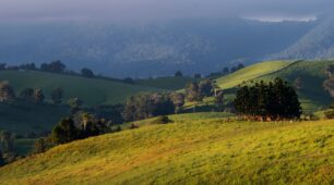 Atherton Tablelands Tours
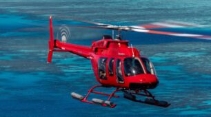 Scenic Flights & Helicopter Tours
 Things to Do in Cairns with Kids
 Adventure and Adrenaline
A Hot Getaways destination. Where Care is Our Compass.
Planning Your Barron Falls Visit
Barron Falls is a dramatic waterfall plunging through Barron Gorge near Kuranda, best known for its roar during the wet season. Here’s what visitors most want to know before they go.
How do I get to Barron Falls?
Barron Falls sits in Barron Gorge National Park near Kuranda, about a 30-minute drive from Cairns. You can reach the lookouts by car, or take in the falls from the Kuranda Scenic Railway and the Skyrail cableway, both of which pass nearby.
What are the best lookouts?
The main viewing platforms are reached via short boardwalks from the Barron Falls Skyrail station and from the national park car park. Queensland Parks and Wildlife Service describes the Din Din Barron Falls boardwalk, lookouts and toilets as suitable for wheelchair access with assistance. Both offer sweeping views into the gorge and across to the falls.
When is the best time to see Barron Falls?
The falls are at their thundering best during and just after the wet season (roughly December to April), when heavy rain swells the Barron River. In the dry season the flow is much gentler, as water is also diverted for hydro-electricity.
Can you swim at Barron Falls?
No — the falls and gorge are for viewing only, with steep terrain and strong currents making swimming unsafe. For a swim, head to the Tablelands‘ designated swimming holes or crater lakes instead.
How long do I need?
The lookouts take under an hour to enjoy, so Barron Falls pairs naturally with a wider Kuranda day out — combining the village, the railway, Skyrail and the falls into one memorable trip.
Frequently Asked Questions
How far is Barron Falls from Cairns? The falls are in Barron Gorge National Park near Kuranda, about a 30-minute drive from Cairns.
When do Barron Falls flow strongest? During and just after the wet season (December to April), when heavy rain swells the Barron River. Flow is much gentler in the dry season.
Can I see Barron Falls from the train or Skyrail? Yes. Both the Kuranda Scenic Railway and Skyrail pass the gorge, with dedicated viewing stops at the falls.
Is there an accessible lookout? Yes. Short boardwalks lead to viewing platforms from both the Skyrail station and the national park car park.
Can you swim at Barron Falls? No. The gorge is for viewing only. For swimming, choose the Tablelands’ designated swimming holes and crater lakes.
What is Barron Falls called in the local language?
Tourism Tropical North Queensland refers to the falls as Din Din Barron Falls. Kuranda Scenic Railway also publishes the traditional story of Buda-dji, the carpet snake associated with the Barron River and the gorge, told by the people whose story it is.
Is the Barron Falls lookout wheelchair accessible?
Queensland Parks and Wildlife Service, which manages Barron Gorge National Park, states that the Din Din Barron Falls boardwalk, lookouts and toilets are suitable for wheelchair access with assistance. QPWS also states that Skyrail Rainforest Cableway has wheelchair-accessible facilities. Gradients and surface details are not published by the land manager, so we do not publish them either. Verified with Queensland Parks and Wildlife Service on 3 August 2026.
Can you reach Barron Falls on Skyrail?
Yes. Skyrail has a station at Barron Falls with panoramic gorge and waterfall views, a rainforest boardwalk loop, The Edge Lookout, a historical precinct and a rainforest interpretation centre. Skyrail states that a one-way journey takes about an hour and a half including time at Red Peak and Barron Falls.
When does Barron Falls carry the most water?
In and just after the wet season. Bureau of Meteorology long-term averages for Cairns Aero are 437.5 mm of rain in February against 26.5 mm in August, and the gorge reflects that difference dramatically. In the late dry season the gorge itself is the attraction rather than the volume of water.
Travel Kindly
At Hot Getaways, care is our compass — and a little kindness makes every journey better. When you visit Cairns, we gently ask you to:
- Protect the reef — wear reef-safe sunscreen and never touch or stand on the coral.
- Respect the wildlife — admire the birds, turtles and rainforest creatures from a distance, and take your rubbish home with you.
- Support local — choosing local operators, cafés and guides helps this beautiful place thrive.
- Honour Country — we travel on the traditional lands and sea Country of Australia’s First Peoples, with gratitude and respect to the Traditional Custodians past and present.
- Be kind to each other — a smile, a little patience and a helping hand make the day lovelier for everyone.
Small acts of care add up to something wonderful. Thank you for travelling kindly.
Honest Suitability: Is Barron Falls Right For You?
We would rather help you choose well than persuade you to go. Here is our honest assessment.
| Visitor | Our honest view | Why |
|---|---|---|
| Visitors with limited mobility | Yes, at the lookout track | Queensland Parks and Wildlife Service, the land manager, states that the Din Din Barron Falls boardwalk, lookouts and toilets are suitable for wheelchair access with assistance. Verified with Queensland Parks and Wildlife Service on 3 August 2026. |
| Visitors with only half a day | Yes | This is the closest major waterfall to Cairns, and it can be combined with Kuranda. |
| Visitors in the late dry season | Yes, with adjusted expectations | Flow drops substantially. The gorge remains impressive; the waterfall does not always. |
| Swimmers | No | This is a lookout and gorge experience, not a swimming site. |
| Visitors who want to arrive by train or cable car | Yes, and this is the memorable version | Both the Kuranda Scenic Railway and Skyrail reach the falls area, and Skyrail has a station there with boardwalks and lookouts. |
Time-Aware and Season-Aware Planning
- Thirty minutes at the lookout itself.
- Half a day combined with Kuranda village.
- A full day if you travel up by Skyrail and back by train, or the reverse. Skyrail states that a one-way journey takes about an hour and a half including time at Red Peak and Barron Falls, and to allow two and a half hours for a round trip.
- Season: Rainfall here is strongly seasonal. Bureau of Meteorology long-term averages for Cairns Aero (station 031011, 83 years of record) are 404.8 mm in January, 437.5 mm in February and 422.1 mm in March, against just 26.5 mm in August, with an annual average of 2,025.5 mm. Source: Bureau of Meteorology climate statistics, Cairns Aero.
Verified Safety Information
Safety comes before everything else on this page. Every point below is drawn from an official source, and we link to those sources so you can check the current position yourself.
- Stay behind the barriers at the lookouts. The gorge walls are steep and the drop is real.
- Rail and cableway operations are weather dependent. Both operators publish closure information, and it is worth checking on the day.
- Queensland Parks and Wildlife Service, which manages these sites, states the position plainly: rivers, creeks and lakes in Queensland’s parks and forests may contain hidden dangers, are not patrolled by lifesavers, and are not the same as a swimming pool — you enter the water at your own risk. Read and follow the on-site signs, never dive or jump into any waterway because the water may be shallow or hold submerged objects, and stay out of the water during and after heavy rain, when creeks can rise quickly and run with strong currents. Source: Water safety, Queensland Parks and Wildlife Service.
- Never dive or jump in. Water depth in a natural pool changes after every flood and submerged rock is not visible from above.
- Queensland Government advice is unambiguous: within the natural range of the estuarine crocodile, which runs from around Gladstone north to the Torres Strait, no waterway can be considered crocodile free. Being Crocwise starts with three steps — keep out of the water, stay more than five metres back from the water’s edge, and keep a sturdy object between yourself and the water. Source: Be Crocwise top tips, Queensland Government.
- Crocodiles are highly mobile, particularly after heavy rain and flooding, and can travel hundreds of kilometres. Queensland Government also states that crocodile interactions can occur at any time of the year, so seasonal reasoning is not a substitute for reading the signage in front of you.
- This is cassowary country. Queensland Government advice is to never approach an adult cassowary, never approach a chick or get between a chick and its father, and never feed a cassowary — feeding is illegal, dangerous, and has resulted in cassowary deaths. Give them space and observe from a distance. Source: Southern cassowary, Queensland Government.
- Check Queensland park alerts and warnings for the Tropical North Queensland region before you leave home, together with current weather and road conditions.
Queensland Parks and Wildlife Service puts it plainly: parks and forests are wild places with hidden dangers for the unwary visitor. Before you leave home, check Queensland park alerts and warnings for the Tropical North Queensland region, along with current weather and road conditions, and pay close attention to warning signs when you arrive.
Every source above was checked and found current on 3 August 2026. Conditions, track access and closures change constantly. Queensland Parks alerts are the current source, and ranger signage on site overrides everything, including this page.
Local Knowledge
The points below are local knowledge and editorial judgement rather than operational facts. They are the things we would tell a friend. Conditions change, so treat them as a starting point and always follow official signage and advice.
- If you have to choose one direction, most people prefer travelling up by Skyrail and coming down on the train. The gorge reveals itself differently each way.
- The falls after a night of heavy rain are a genuinely different sight from the falls in September. If your dates fall in the wet, this is one of the things the wet season gives you rather than takes away.
- The Kuranda side has the crowds and the coach timetable. Late afternoon, after the last train has gone down, is the quietest hour at the lookout.
- Look for the story rather than only the water. The gorge has been carved, in the telling of the people who belong to it, by Buda-dji the carpet snake.
Helping Look After This Place
Part of the pleasure of a place like this is knowing it will still be here, just as beautiful, for the people who come after you. A few small choices make a real difference.
- Take everything out that you brought in, including fruit peel and tissues, which do not break down as quickly as people expect in the rainforest.
- Stay on the formed tracks. It protects fragile root systems and stops new informal paths forming, and it is also the single simplest way to stay safe.
- Give wildlife room and resist the urge to feed anything. Queensland Government advice is that feeding cassowaries is illegal, dangerous and has resulted in cassowary deaths.
- Support the small local businesses you pass. A coffee in a village bakery or an entry fee at a family-run attraction is what keeps these communities able to look after the places you have come to see.
- Sunscreen, insect repellent and soap all end up in the water when you swim. Rinsing off before you get in, and swimming without them where you can, is a small kindness to a small creek.
- The Wet Tropics Management Authority acknowledges Rainforest Aboriginal Peoples as the Traditional Custodians of the Wet Tropics. Where a site has a traditional name or story, using it is a quiet way of recognising a connection that long predates tourism.
Barron Falls in the Wet Season
Between November and April this is a different place. The rainfall that defines the wet season is precisely what makes the waterfalls of Far North Queensland worth travelling for — and it is also what makes them worth treating with respect.
What the wet season gives you
Volume, sound and colour. Falls that are elegant in September become genuinely powerful between January and April, the rainforest around them is at its most saturated green, and the light after a storm is something photographers plan whole trips around. It is also the quietest time of year at the popular sites.
What Queensland Parks and Wildlife asks you to understand
QPWS is direct about this, and it is worth reading before you go rather than at the car park:
- Rivers, creeks, lakes and beaches in Queensland’s national parks and forests are not patrolled by lifesavers. You enter the water at your own risk.
- During and after heavy rain, creek conditions can change and become dangerous, with fast-flowing, rapidly rising water and strong currents. QPWS advice in those conditions is simply not to enter the water.
- Never dive or jump into any waterway — the water may be shallow, or there may be submerged objects.
- Use the established tracks to reach the water, and take care on wet, slippery rocks.
- Always read and follow the on-site signs. They are specific to that site and are there for a reason.
Full guidance is on the QPWS water safety page, and current closures and conditions are published as park alerts — which is the page to check the morning you go, rather than relying on anything written in advance.
Crocodiles move with the water
The Queensland Government’s Be Crocwise guidance notes that crocodiles are highly mobile, especially after heavy rain and floods, can travel hundreds of kilometres, and are found in all types of waterways. It states that no waterway within their natural range can be considered crocodile free. Keep out of the water, stay more than five metres from the water’s edge, and keep a sturdy object between yourself and the water where you can. See Be Crocwise top tips.
Barron Falls is the one that transforms
Of all the falls near Cairns, Barron Falls changes most dramatically between seasons. In the dry it is a modest curtain over a broad rock face; after heavy rain in the wet it becomes a torrent that you hear from the car park. The Barron Falls lookouts and the Skyrail and Kuranda Scenic Railway viewing points are all designed for exactly this, which makes it the safest of the region’s great wet season sights — you see it at full power from a built platform, with nothing asked of you but a short walk.
Wet season or dry season? The honest trade-off
The wet season suits you if you have come to see the falls at their most powerful, you are happy to look rather than swim, and you can check conditions on the morning and change plans if they have changed.
The dry season suits you if swimming is the point. From about May the water drops, clears and slows, tracks are reliably open, and the swimming holes of the region are at their most inviting — gentler, but far more usable.
The question people ask next
“How do I know if it is safe on the day?” — Check park alerts before you leave, check QLDTraffic for the road, and then read the signs at the site itself. If the water is brown, fast or higher than it was, that is the answer, and no view is worth arguing with it.
Safety guidance on this page is from Queensland Parks and Wildlife and the Queensland Government Be Crocwise programme, each within its own area of responsibility, checked 3 August 2026. In any emergency, dial 000.
Where To Go Next
Barron Falls sits at the junction of several journeys. These are the natural next steps.
- Skyrail Rainforest Cableway — Reaches a station at Barron Falls with boardwalks, The Edge Lookout and an interpretation centre.
- Kuranda Scenic Railway — The heritage railway through the gorge, in operation since 1891.
- Kuranda — The village at the top of the range.
- Millaa Millaa Falls — If you want a waterfall you can swim in.
- Atherton Tablelands — Beyond Kuranda, the highland region opens up.
- All Waterfalls Near Cairns — Compare every waterfall in the region on one page, including which ones are officially listed as accessible.
- Swimming Holes Near Cairns — If a swim matters more than the drop.
- Rainforest and Waterfalls — The wider decision hub, including guided options and rainforest walks.
- Atherton Tablelands — Towns, produce, crater lakes and the cooler country above Cairns.
- The Waterfall Circuit Drive — The classic Tablelands waterfall drive, turn by turn.